Cultural Notes — Landscape & Survey History
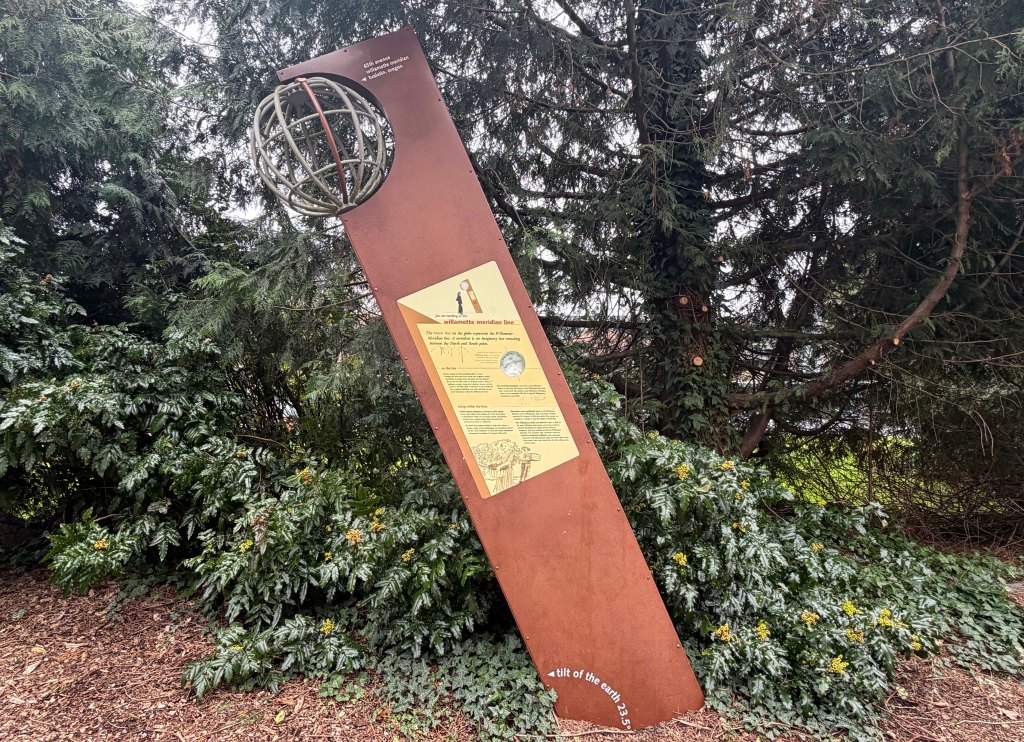
A leaning monument tucked among trees in Tualatin marks something that cannot actually be seen. The sculpture identifies the path of the Willamette Meridian, an invisible surveying line that helped shape land ownership across the Pacific Northwest. Though the line exists only on maps, it still runs quietly through the landscape beneath the park.
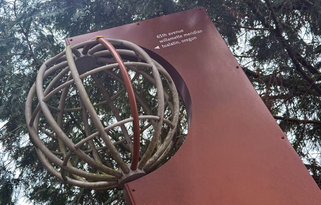
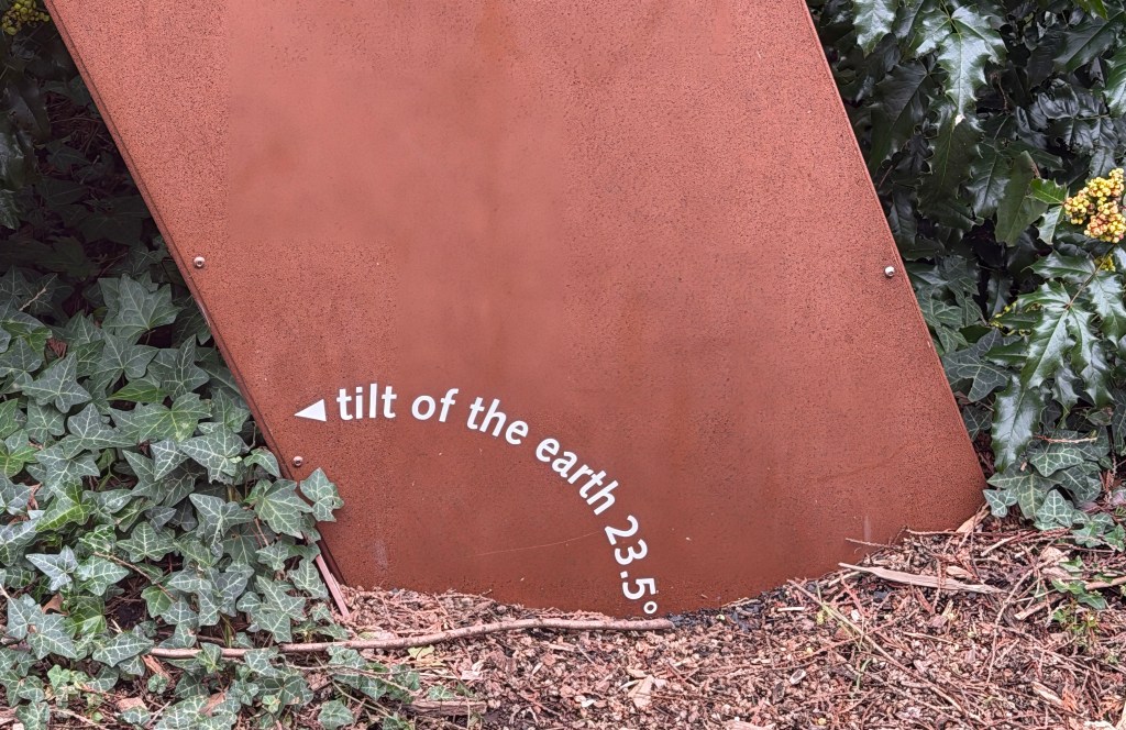
The monument stands near the path of 65th Avenue, which closely follows the meridian as it passes through the city. The structure tilts deliberately, referencing the 23.5° tilt of the Earth, while a metal globe at the top illustrates the concept of a meridian — a line stretching from the North Pole to the South Pole.
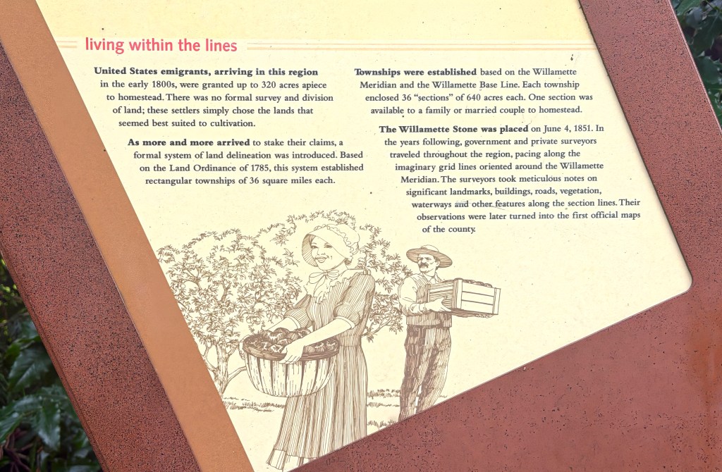
Interpretive panels explain that the Willamette Meridian was established in 1851 as part of the Public Land Survey System. Surveyors used the line, together with the east–west Willamette Base Line, to create a grid that divided land into townships and sections. Each township contained thirty-six sections of 640 acres each, forming the system that still underlies legal land descriptions today.
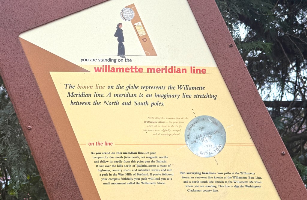
If one were to follow the meridian north from this point, the line eventually reaches the Willamette Stone in the West Hills of Portland. A cedar stake placed there on June 4, 1851 became the “initial point” from which the region’s land surveys were measured.
The monument also notes that the meridian here coincides with the boundary between Washington County and Clackamas County, meaning the invisible survey line continues to function as a political boundary.
Most visitors passing through the area are unlikely to notice the marker, and even fewer realize they are standing on a line that helped define millions of acres of land across the Pacific Northwest.
Yet the monument quietly marks one of the most important geographic reference points in Oregon’s history — a reminder that the landscapes we move through every day were once carefully measured, mapped, and divided along lines that still shape the region, even when they cannot be seen.

You must be logged in to post a comment.